
Scottish islands are all mapped out by drone
The inner Hebridean islands of Canna and Sanday have emerged as world leaders in the application of digital mapping technology.
Owned by conservation charity the National Trust for Scotland, they are now the subject of the most detailed mapping exercise ever undertaken of any islands anywhere on the planet.
With project funding generously donated by its Members’ Centres in London, Argyll and Angus, the Trust commissioned Glasgow-based GeoGeo to carry out a drone survey of the island in November 2018 using an ultra-high definition camera with the aim of pinning down the exact locations of archaeological features.
The drone not only achieved this but also revealed hitherto unknown archaeology.
The images have been processed to create a minutely detailed 3-D map of Canna and Sanday, which is even capable of being used in a 3-D printer to create scale models of the islands.
Derek Alexander, head of archaeology at the National Trust for Scotland
Paul Georgie, founder and lead geospatial technologist of GeoGeo said: ‘The drones we use aren’t those commonly for sale to the public; they represent the most advanced autonomous systems available – miniature fixed wing aircraft built for larger mapping missions like this.
‘We spent five days on Canna last November in miraculously calm and clear weather, with our flying robot navigating itself over 400km to capture over 4000 images of the islands. We then took this data and processed on self-built super computers to produce the most complete 3-D map of the islands to date.
‘This not only shows detailed topography and vegetation at a game-changing three centimetres resolution but, with over 420 million data points, is currently the world’s largest complete island dataset captured by drone.’
Derek Alexander, the National Trust for Scotland’s head of archaeology said: ‘We’ve previously recorded archaeology on Canna and Sanday which proves that there were inhabitants as far back as the Neolithic but this survey gives us information and detail we just haven’t had until now.
‘We’ve been able to obtain exact plots of known sites but also recorded the extensive traces of cultivation, such as rig and furrow field systems that range in from the Bronze Age onwards.
‘At its peak in the 19th century, agriculture on Canna and Sanday was capable of supporting a population of 400.
‘The detail is simply astounding – aerial surveys for archaeology have been around since the end of World War Two but this new technology takes everything into a completely new realm, being considerably more detailed, affordable and flexible.
‘My colleagues in the Trust were blown away by the results and the possibilities of this technology – the cameras allied to “self-learning” software will be able to help us do things like seabird counts, as well as habitat and coastal erosion monitoring that are currently expensive and labour-intensive.’
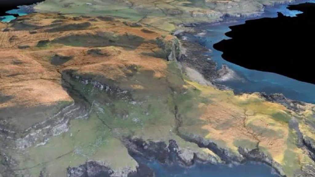
The digital map of Canna and Sunday (Photo: GeoGeo)
Paul added: ‘One of the Trust’s concerns was that bird life shouldn’t be disturbed by the survey work. As it happens, we were more worried about the drone being attacked by the white-tailed sea and golden eagle populations, and we had evasive functions at the ready, from barrel rolls to Immelmann turns, to avoid contact.
‘Fortunately, although birds did take a passing interest, we had no need to use this over Canna.’
The Trust is now studying the detailed maps produced and will use them to update archaeological records and to prepare for future groundwork and excavations.
In the meantime, the technology platform ‘Alba3D’ developed by GeoGeo is being improved almost daily, providing new opportunities to analyse and integrate other datasets, drawn from local community knowledge and observation as well as Scotland’s public/private agencies, into a virtual 3D world.
Paul said: ‘This is a fantastic moment for geography and the geospatial industry, with autonomous drones and big data platforms like Alba3D helping to democratise Scotland’s ability to monitor increasingly changing environments and share our local geographies with a global audience in new and innovative ways.’
TAGS
FOLLOW US
